How to read weather maps: National Weather Service Weather Maps
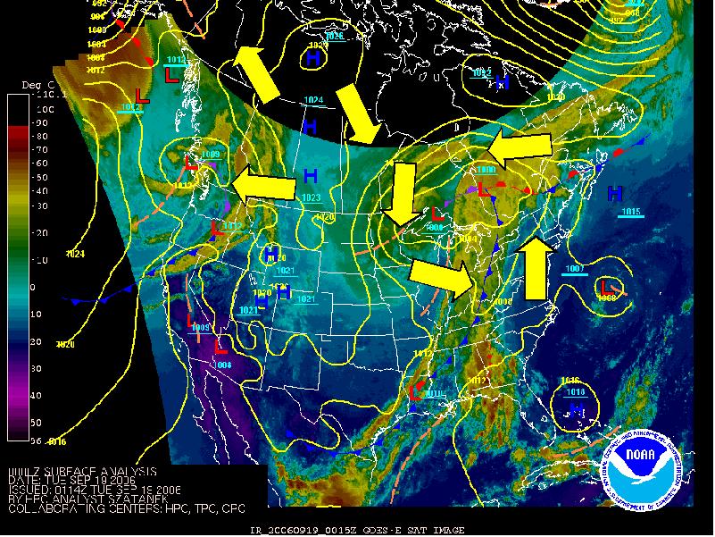
Sea link above for access to current weather maps and forecast maps. This evenings sea-level pressure and satellite map illustrates come classic features of low pressure, high pressure, fronts, and their associated circulations.
- There is a counterclockwise circulation around the low centered over western Quebec. You should be able to picture this whenever you see alow
- An elongated zone of cloud and precipitation stretches out along the cold front of the low. This wll give us rain as it passes over us tomorrow. It will also usher in cooler, drier conditions of the cP air mass transported in by the northwesterly winds west of the low. and cold front.
- Soutwesterly winds prevail over New England, transporting in what's left of cT airmass that originated over southwestern desert.
- There is a broad zone of cloud and preipitation north of the warm front that extends east of the Low over much of Quebec.
- A clockwise circulation around the High over northwestern Canada. This helps push down cP air from Northern Canada to behind the cold front.
posted by ProfWW @ 12:48 AM
0 comments
![]()


0 Comments:
Post a Comment
<< Home