Monday, December 18

ProfWW Rant I


Good blogs, but I have to rant.

It's not your fault that you use these words (you probably hear them all the time on TV weather reports) but I'm starting to lose it everytime I see or hear the words:

"As you can see ..."

I hate this expression. What's worse, it's so ubiquitous that I find myself using it when I describe the weather in a lecture and need to pause and think about what I'm about to say next.

So what is so bad about it?

Not only is it useless filler, it insults the audience:

a) If the audience actually sees what you're talking about, it's patronizing and they say "Of course I can see". b) If they do not see it, they either 1) feel stupid or 2) they might think that you're an idiot doing a really bad job of explaining it (being a Met professor, I tend to fall in the latter category).

So you cannot win by using it.

I swear, any TV meteorologist who uses these words should have their tongue strung up to a cold metal handrail in a snowstorm.

If weathercasters really need to fill up on-air time with useless words, they should try using something more intelligent and less patronizing like "duuuuuuuuh" .....

There, I feel better now.

Otherwise, great blogs, people (well, most of them anyways)!
Friday, December 8

Hint 4


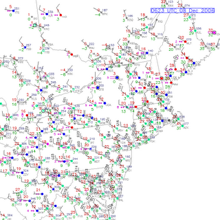
Click on the image at left for a close-up view of the situation in the Northeast. Golly. The winds are all coming from the same direction everywhere.

Note the temperature at Littleton (HIE) just across the border in New Hampshire. Now look at the temperature northwest just across the border near my home in Frelighsburg, Quebec (WFQ). Please read these temperatures and compare. Brrrr. Now go northwest again to my hometown of Montreal (YUL), and then go to the ski resort of Saint Jovite (YJT) in the Laurentian Mountains northwest of
Montreal. Observe the temperatures. Double brrrrr. This looks like a temperature gradient to me.

I now have to drive home late after helping you with this blog. Good thing I have studded tires. I hope the cars coming the other way on those highways have them too. When it freezes this quickly, there is often ice under that snow. If you're out on the roads, slow down and drive safely. I certainly will.

Hint 3

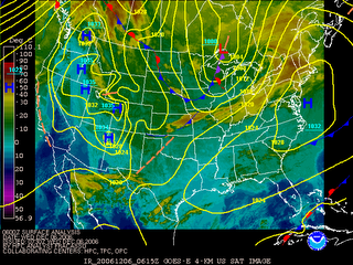
Here's the situation early Friday morning as I write this blog. This map indicates that we are in for cold blast. Those minimum temperatures are going to be something to watch tonight and tomorrow.

How do I know?

Note the weather system dominating all of the United States. It is very large. It is hard to miss. So is the circulation around that system. We've discussed this circulation in almost every investigation.

Note also the direction of the wind over New England associated with this circulation. Note also the temperatures upwind of Vermont. Also, keep your eye on the skycover. Clear or cloudy skies at night will make a difference.

To quote Avril Levigne in her smash debut hit of "Skaterboy": "Could I be anymore obvious"?

Hint 2

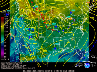
What a difference a day makes! 24 hours later, the situation is very different int he darkness of early Wednesday morning. That Alberta clipper that several of you have identified is over the Great Lakes. This positioning has an affect on the temperature advection over us. You will note that the cloud over over Vermont is radically different. How does this affect high and low temperatures?

Hint 1

Here's an image of Tuesday morning. take note of the sky conditions and the wind conditions over Vermont. This will explain the very cold temperatures that morning. Anyone come up with a low temperature?

Thursday, December 7

Problems viewing Blog?

If you cannot view your new posts, remember to hit the "Refresh" or "Reload" button of your web browser.

Monday, October 2

Today's weather III: Wrap-around cloud and moisture


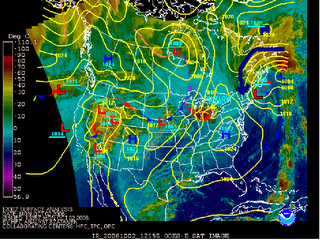
The map at left shows that the mP air that is affecting Vermont today is wrapping around a low pressure system parked off the coast of New England. The circulation around this system is counter-clockwise as indicated by the dark blue arrow (arrow ends over Vermont). This advects in cloud and cool moist air from the North Atlantic (remember, advection refers to wind transporting an air mass). This mass of cloud and moisture is called "wrap around" becasue it appears to curve around the center of the low pressure system.

Note that the blob of cloud off the coast of Newfoundland is the remnants of tropical storm Isaac. The wrap-around today is particularly moist because it taps into the huge amount of cloud and water vapor associated with this storm.

You can view an animation of this system for the past few days by clicking here. Pay attention to the dates at the bottom left of the images.

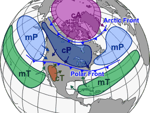
Today's weather: II Marine polar (mP) air mass


Cool, damp weather almost always means we're under the influence of a marine polar (mP) air mass miving in from the North Atlantic Ocean. Coastal New England sees this type of air far more frequently than Vermont, but Vermont has its fair share of foggy, drizzly days due to mP air masses. The map at left shows that we need easterly or northeasterly winds to bring this air into Vermont.

Today's weather: I Climatology + Current conditions


Here's a few pointers on places to look for temperature data on the web and (more importantly) how to use it.

Climatology for a given day is based on thirty-year averages. It gives you an idea of what the normal temperature is for a given date. The Weather Channel has an easy-to-use website for this (click here). Note that this information is for St. Johnsbury as opposed to Lyndon State college, so that conditions might be slightly different.

For October 2, the average high temperature is 63 F, and the average low temperature is 41 F. Record high and low temperatures are also given.

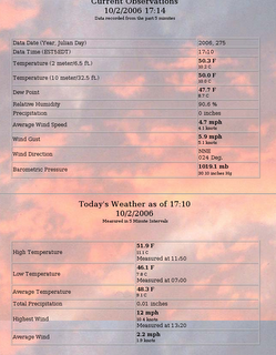
You may have noticed that it feels cool and damp outside today. You can confirm this by checking the high and low temperature for today at the course weatherpage. Clicking on the "Details" link (shown at left for time of this blog) or going to the "Archive" link under "Current Conditions" indicates a high of 52 F and a low of 46 F.

This illustrates the effect of clouds on temperature. Because clouds block out the sun, the earth does not heat up as much as it might on a sunny day. On the other hand, clouds (especially low-level clouds) also act as a greenhouse agent, absorbing outgoing longwave (IR) radiation and emitting it back towards the Earth's surface. Therefore, the nightime low (46 F) was higher than the normal (41 F) for October 2.

Note that over all, the average temperature for today (48 F) is lower than the climatological mean (52 F) for this date. We appear to be under the influence of a cold air mass.

Why?

Friday, September 29

Quiz preview


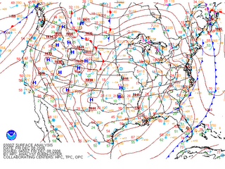
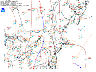
Lucky you! A little preview for the quiz. Clicking on the image at left will give you an idea of the situation last Thursday night as a cold front (blue line) approached Vermont (and all of the Northeast) from the west.

Warm advection is taking place in the southerly winds of the warm sector ahead (east) of the front. A sliver of warm air in excess of 60 degrees F slips into western Vermont. The warm advection is most evident along the coast of New England and New Jersey where south winds cross isotherms at right angles.

Cold advection is most in evidence directly behind the cold front where northwesterly winds cross isotherms from cold to warm portions of the map, slowly pushing that cold air towards Vermont. It's a safe bet that Friday will bring at least a 15 degree F drop in temperatures.

Thursday, September 28

Some thunderstorms


Thursday night. Only one person at the tutorial to witness this cold front arriving. Note the warm advection ahead (east) of the cold front. Strong southerly winds bring in warmer temperatures exceeding 70 degrees F over Vermont. Behind (west of) the front, we see cold advection, with northwesterly winds and temperatures in the the mid 50's. Looks like the rain will start around 9 PM. See animation of this map here.

Tuesday, September 26

Global temperatures reach new records

A study from NASA shows that temperatures are now the highest they've been in 18 000 years.

'The most important result found by these researchers is that the warming in recent decades has brought global temperature to a level within about one degree Celsius (1.8° F) of the maximum temperature of the past million years, which they suggest is a sensible upper limit for additional global warming. “If further global warming reaches 2 or 3 degrees Celsius, we will likely see changes that make Earth a different planet than the one we know. The last time it was that warm was in the middle Pliocene, about three million years ago, when sea level was estimated to have been about 25 meters (80 feet) higher than today.”'