Saturday, September 23

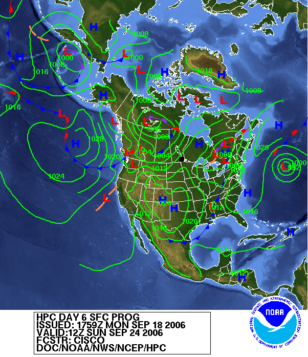
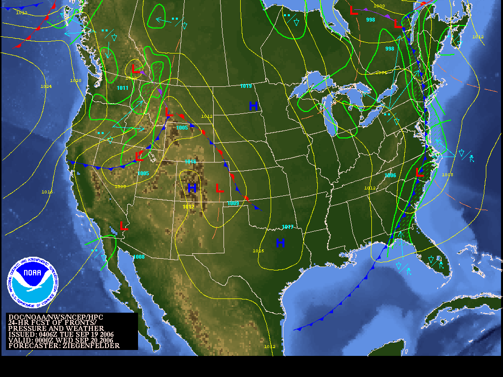
Surface/Sat analysis

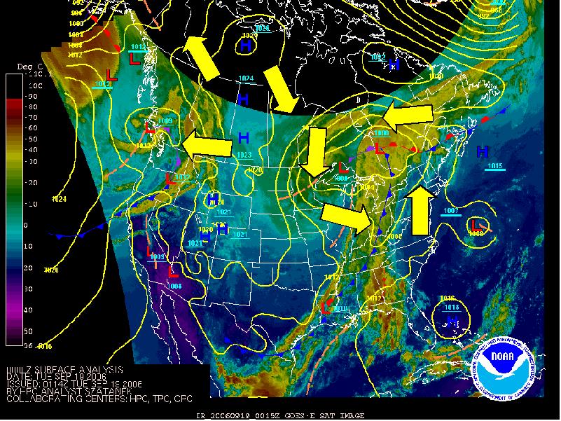
Click on left image for large image. Current satellite image can be found at Unisys. The image shows radar echoes over southern Illinois in the area of the blob on the satellite image below. These are thunderstorms that spawned the severe weather in this region.

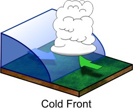
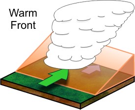
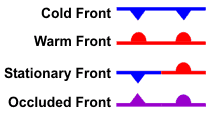
Note also that these thunderstorms occur in a region of southerly winds that push a warm front northward. South of the warm front, temperatures are generally on the 90's. North of the warm front, temperatures are in the 60's. The 30 degree contrast in temperatures indicates that this is a strong front that contributes greatly to the outbreak of severe weather. Note also the occluded front (pink) that also helps to trigger the storm outbreak.

Friday, September 22

Nasty weather in Midwest II

Severe storms have broken out at the locations indicated on the map at left. These storm reports correspond to the location of the red blob on the satellite picture below. As I'm writing this, there have been 23 tornado reports, 17 reports of damage due to high winds, and 57 reports of hail (including one of softball and baseball sized hail in Douglas Missouri!!). For a complete list of reports from the Storm Prediction Center, click here.

Nasty weather in midwest

Compare the IR satellite image here with the one from yesterday. The zone of upper level clouds (indicated by yellow) has moved into the northeastern United States from the Great Lakes region. Those are the lovely high-level cirrus clouds that are gracing our sunset this evening in the photo below.

However, in the midwest it is a different story. The dark red blob over the midwest (Missouri and southern Illinois, to be exact) indicates very nasty weather. It represents a region of very cold cloud tops over a wide region. Very cold cloud tops like this only occur in the presence of numerous very severe thunderstorms. The ascent in these systems is so strong that the clouds shoot up into the cold stratosphere. It's very bad news for people living here.

You can access a current image and loop of this ehhanced image at the LSC Satellite Imagery Page.

Current skies over LSC

What a gorgeous day at LSC! For freshman activity, we climbed Mount Pisgah near Lake Willoughby and watched the cirrus cloud associated with the storm system to the west of us slowly move in (see picture). Should make for a spectacular sunset!

Thursday, September 21

Satellite picture

This satellite picture shows low pressure sustem just west of the Great Lakes. Click on image to enlarge image!

Tuesday, September 19

A six-day forecast

This is a six day forecast valid next Sunday morning at 12Z. It shows the family of low pressure systems previously over the Rockies has migrated northeastward and resides over eastern Canada. Once again, there is southwesterly flow ahead of this system over New England (if you imagine the wind going counter-clockwise around the low, you'll see that it is southwesterly ahead of the cold front that extends down to the Gulf of Mexico. It looks like a warm weekend coming up, with the front only passing through after Sunday. 6-day forecasts like this are usually not very good, though.

Forecast map

Here is the forecast map valid 0Z Wednesday, or Tuesday evening at 8 PM EDT. The low pressure system has moved into Quebec and the cold front extends southward into Vermont. A narrow band of precipitation is forecast along the cold front. A ridge of high pressure now extend from Western Caanda al the way to Texas. A famly of low pressure centers resides over the Rockies. These will move across the continent for the latter part of the week.

How to read weather maps: National Weather Service Weather Maps


Sea link above for access to current weather maps and forecast maps. This evenings sea-level pressure and satellite map illustrates come classic features of low pressure, high pressure, fronts, and their associated circulations.
  • There is a counterclockwise circulation around the low centered over western Quebec. You should be able to picture this whenever you see alow
  • An elongated zone of cloud and precipitation stretches out along the cold front of the low. This wll give us rain as it passes over us tomorrow. It will also usher in cooler, drier conditions of the cP air mass transported in by the northwesterly winds west of the low. and cold front.
  • Soutwesterly winds prevail over New England, transporting in what's left of cT airmass that originated over southwestern desert.
  • There is a broad zone of cloud and preipitation north of the warm front that extends east of the Low over much of Quebec.
  • A clockwise circulation around the High over northwestern Canada. This helps push down cP air from Northern Canada to behind the cold front.

How to read weather maps: Winds around High and Low pressure systems

The winds around High and Low pressure systems are what transport air masses northward and southward. These systems generally move from west to east across the continent. Compare this image to that of the air masses below.
  • Winds around lows blow counter-clockwise and slightly inward towards the low pressure center
  • Winds around highs blow clockwise and slightly outward from the high pressure center
  • Winds ahead (east) of low pressure systems and behind (west) of high pressure systems tend to be southerly and bring in cT or mT air masses
  • Winds behind (west of) lows and ahead (east) of highs tend to be northwesterly and bring in cP air masses.

How to read weather maps: Cold front

The polar air mass behind a cold front forms a sharp wedge that pushes under and lifts the warm, humid air ahead of it. This often triggers a sharp, narrow zone of cloud called a "comma cloud".

How to read weather maps: Warm front

Advancing warm air overruns cool air, forming a broad region of cloud ahead (usually north) of the front.

How to read weather maps: Fronts

Cold front: represents cold polar air mass advancing in direction of triangle
Warm front
: represents warm tropical air mass advancing in direction of semicircle
Stationary front
: doesn't move, which usually meeans a long spell of cloudy, rainy weather
Occluded front
: Occurs near center of low pressure systems as cold front catches up to warm front
  • Fronts are important because divide air masses and bring in temperature and humidity changes. They are also are associated with ascending motion, cloud and precipitation.

Monday, September 18

How to read weather maps: Airmasses


Here's a quick review on how to read weather maps. Keep in mind that this can all be found at the Jetstream website

Airmasses

The figure at left shows the main air masses that affect our area. The heat of an airmass is determined by the temperature. The moisture is measured using the dewpoint. Winds associated with high and low pressure systems transport these air masses so that our temperature in the northeast constantly changes. The polar front divides cooler polar air masses from warmer tropical ones and shifts back and forth. The airmass that dominates us usually depends on the prevailing wind.
  • Continental polar (cP): cool, dry air brought in by northwest wind
  • Continental tropical (cT): warm, dry air brought in from Soutwestern desert
  • Maritime tropical (mT): warm, humid air brought in from Gulf of Mexico by southerly winds
  • Maritime polar (mP): cool, humid air brought in by eastern or northeasterly winds


Sunday, September 17

Precipitation less than forecast

Weather Summary for 9/14/2006
Measured in 5 Minute Intervals

High Temperature 64.2 F Measured at 13:10
Low Temperature 52.2 F Measured at 00:05
Average Temperature 58.6 F
Total Precipitation 0.17 inches
Highest Wind 7.16 mph Measured at 15:55
Average Wind 1 mph
From LSC weather station archive


Looks like not nearly as much precipitation fell on Thursday as was forecast two days ahead of time. This is not unusal. Precipitation amounts are one of the most difficult parameters to forecast. The computer models that meteorologists rely on to predict weather often overdo rain fall. This is why forecasters are often reluctant to forecast precipitation amounts more than one day ahead of time.